Scope of Work
FLOOD RISK MANAGEMENT AND MORPHODYNAMICS
- Flood estimation and risk assessment for the design of infrastructure projects, new housing or industrial development (from individual sites to regional level)
- Feasibility studies, Conceptual Master Plan and Detailed Project Report for flood reduction measures
- Land drainage works
- Flood control and management of river, sea, reservoir, and ground water flooding
- Decision support system and real time flood forecasting system for rural and urban flooding
- Flood zone mapping for insurance, smart city and regional planning studies
- Hydrologic and Hydraulic modelling studies
- Design and operation of hydraulic structures
- Morphodynamic studies for mitigating floods, restoration of rivers, lakes and coasts
- Dam break analysis
- Post flood study analyses
- Adaptive river delta planning
IRRIGATION AND WATER RESOURCES MANAGEMENT
- Compendium Planning for Irrigation Command Area
- Water Availability Studies, Capacity assessment
- Integrated River Basin Planning
- Feasibility Reports and Detailed Project Reports
- Design of Hydraulic Structures
- Extension, Renovation and Modernization.
- Cyclone protection works
- Water Management and On Farm Development works
- Restoration and Rejuvenation of Tanks
- River Rejuvenation
- Rejuvenation of Traditional Irrigation and Water Conservation Systems
- Participatory Watershed Management
- Sustainable Groundwater Management
- Leak detection and Turnkey solution
CONSTRUCTION PHASE SERVICES
- Project Management and Construction Supervision
- Third Party Construction Supervision
- Review of Design, Drawings, Estimates & Reports
- Establishing Base Lab and Mobile Labs
- Quality Assurance Plan
- Measurements and Certifications of Contractors Men and Machineries
- Draft Tender Documents & Tender Evaluation.
- Development of Web based Project Progress Monitoring System
WEB ENABLED GIS
- GIS based Asset Management Systems
- GIS based Decision Support Systems
SURVEY AND INVESTIGATION
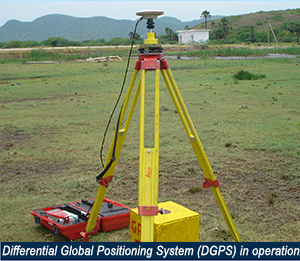
- Topographic and Hydrographic Survey
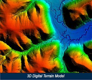
- LiDAR, HRSI or UAV derived DEM, catchment delineation, channel network
- Reservoir Capacity Survey
- Bathymetric Surveys
- Submergence and Land Acquisition Survey
- Rehabilitation and Re-Settlement Survey
- Socio Economic Survey
- Geotechnical Investigation
- Construction Material Survey and Soil Survey
Major Projects
PREPARATION OF CONCEPTUAL MASTER PLAN TO MITIGATE FLOODS IN NORTH GUJARAT
NARMADA VALLEY DEVELOPMENT AUTHORITY (NVDA) GOVT. OF MADHYA PRADESH
- Survey, Investigation, DPR and Detailed Estimate for Medium and Minor Projects in Narmada Basin covering 12679 Sq Km
- Survey, Investigation, Design, drawings, Estimates & DPR for Morand and Ganjal Complex Project covering 2600 Sq Km
- Project Management Consultancy Services for Punasa Lift Irrigation Scheme (350 Sq Km) and Omkareshwar Lift irrigation Scheme
FIRST INDIAN AIRBORNE LIDAR SURVEY FOR FLOOD IMPACT ASSESSMENT IN RAJASTHAN
UTTAR PRADESH WATER SECTOR RESTRUCTURING PROJECT, GOVT. OF UTTAR PRADESH
- Survey, Investigation & generation of GIS database for an area of 6,15,658 Ha and 2.50 million parcels (World Bank project)
KRISHNA BHAGYA JALA NIGAM LIMITED (KBJNL), GOVT. OF KARNATAKA
- Survey, Investigation, Design, drawings, Estimates for Indi Lift Canal (30,000 Ha), Chimmalgi LIS (40,000 Ha)
- Detailed Project Report, Design, Estimates for Anachi, Sank & Bhuyar Lift Irrigation Schemes
KARNATAKA NEERAVARI NIGAM LIMITED (KNNL), GOVT. OF KARNATAKA
- Survey, Investigation, Detailed Estimates and DPR for Restoration of MI tanks in Kolar,Tarikere, Kadur taluks under Upper Bhadra Project
- Survey, Investigation, Cost Estimates for Chitradurga Branch Canal under Upper Bhadra project
- Modernization and Rectification/Remodeling of existing canal system of Amarja project (100 Km)
CADA, IRRIGATION DEPARTMENT, GOVT. OF ANDHRA PRADESH
- Micro Network for Sri Sailam Right Bank Canal (7800 Ha) (World Bank project)
UTTAR PRADESH BHUMI SUDHAR NIGAM, GOVT. OF UTTAR PRADESH
- Project Management and Construction Supervision for Rehabilitation & Resettlement of Drains in 25 districts (World Bank Project)
SARDAR SAROVAR NARMADA NIGAM LIMITED (SSNNL), GOVT. OF GUJARAT
- Project Management Consultancy services for EPC and Item rate Contracts for construction of Branch canals and Distribution Network
WATER RESOURCES DEPARTMENT, GOVT. OF MADHYA PRADESH
- Survey, Investigation, Design, Estimates & DPR for Panchamnagar Project (56,200 Ha) and Bariyarpur Right Bank Canal project (20,500 Ha)
CENTRAL INSTITUTE OF COASTAL ENGINEERING, BANGALORE
- Survey, Investigations, Design of Cyclone Protection Bunds, Dykes etc for Brackish Water Shrimp farms (World Bank Project)
UNDER WATER LEAK DETECTION, KIOCL, GOVT. OF KARNATAKA
- Arresting leakage at the intake well and exit portal of gravity tunnel Design, Installation and Supervision of Regulating arrangements at Lakya Reservoir
NARMADA WATER RESOURCES WATER SUPPLY AND KALPSAR DEPT., GOVT. OF GUJARAT
- Feasibility, Design of Barrage and allied works, Bid document on PPP model across river Narmada, near village Bhadbhut, district Bharuch
- Survey, Investigation, Design and Estimates for Narmada Diversion Canal (34 Km)