Scope of Work
SECON and its partners offer Airborne and mobile LiDAR Acquisition services in India for all applications and across all terrains and areas from small city areas to large multi-state areas.
For global projects, SECON offers a full range of LiDAR data compilation services.
SECON specializes in the entire spectrum of LiDAR data compilation with experienced staff, advanced LiDAR data processing software and workstations.
SECON has the one of largest LiDAR data processing teams in india. SECON was one of the pioneers in starting LiDAR data processing services in India.
The LiDAR data service areas include
- Digital Terrain Modeling and contour generation
- 3D city and feature Modeling
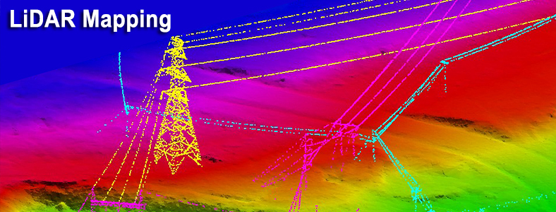
- Asset Management (Power line, Pipeline, Highways)
- Heritage, Tunnel and as-built mapping
- Geodatabase creation
- Customized LiDAR tool software development and automation.
Major Projects
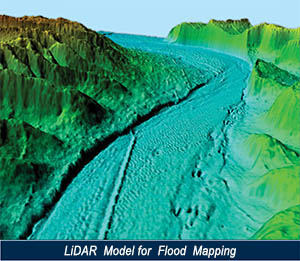
First Indian Airborne LiDAR Survey for Flood Impact Assessment in Rajasthan
SECON has completed more than 550,000 sq km of LiDAR Data Compilation Projects for International Clients.
SECON has completed the above Projects for varied terrains across the globe in North America, Europe, Asia, Africa, Middle East and Australia.
This includes:
- Flood Plain Mapping
- Infrastructure Mapping(Roads, Power lines, Drainage System)
- Urban Mapping
- Soil Erosion (Sea and River)
- Mining
- 3D City Modeling
- 3D Digital Terrain Modeling