Scope of Work
HYDROGRAPHIC SURVEY
Work includes Control Survey, Sub-bottom Profiling, and Related Investigations by using DGPS, Eco Sounders and Lead Lining. Other services include Tidal Observations, Harmonic Analysis, Study of current & wave.
HYDROLOGICAL SURVEY
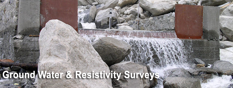
Job consists of study of Upstream and Downstream Bank and Bed conditions, Data Collection regarding High Flood / High Tide levels for calculation of couring depth, catchments area study & discharge to design waterways, capacity survey and sediment analysis. We take up resistivity surveys to assess water table, yield and pumping head.
RIVER MORPHOLOGY
SECON has significant experience in river and ocean engineering related activities encompassing hydrographic surveys, subsoil investigations, study of river morphology, current, wave and tide analysis, etc. SECON also undertakes capacity and sedimentation surveys for hydraulic model review, study of flow pattern of rivers, details of catchments area, perenniality based on available data, effect of existing hydraulic structures both upstream and downstream within the influence area such as dam, intake structures, regulators, etc
- Study of bathymetry of riverbed and current.
- Tidal influence due to proximity to coast, extent to tidal influence
- Study of surge during floods/ cyclonic storms
- Study of siltation pattern, identification of sites for dumping dredged materials.
- Study of protective measures to bank, such as revetment, wharf, etc.
- Study of effect of filling low-lying areas/reclamation (on either side of the river banks)
- Recommendation regarding finish grade levels (FGL) including generation of data for hydraulic model study
Major Projects
- Zuari and Mandovi rivers
- Hydrographic Survey and investigation for horizontal direction drilling across Narmada and 5 other rivers
- Total onshore and offshore survey and investigation for setting up brackish water shrimp farms in Orissa and Andhra Pradesh (World Bank Aided).
- Total onshore and offshore survey and investigation for setting up brackish water shrimp farms in Muttupet & Karaikal in Tamil Nadu.
- Onshore and Offshore comprehensive survey and investigation for 14 Km long navigation channel, landing jetty, etc.
- River Narmada, Tena, Bhuki, Kim
- 17 major river crossings for Bailadila -Visakhapatnam Slurry pipeline – 400 km
- Conducting model studies for setting up fishing Harbor at Karaikal.
- Investigation across Narmada river
- Hydrographic survey and hydrological investigations of 1.9 km long Narmada river
- Hydrographic Investigation for Mini River and Pet land branch canal along Baroda – Ahmedabad – Kalol Pipeline.
- Hydrographic survey and hydrological investigation for model study of Gurpur and Nethravati river
- Inundation and Hydrological investigations of river Bhadra for sedimentation analysis.
- Underwater leak detection study, design of structures and construction supervision
- Hydrological survey and investigation for 8 river crossings for Cochin-Karur Pipeline, Kerala State.
- Preparation of project report for shrimp farm project at Vanagiri (Tamil Nadu)
- Hydrographic survey of entrance channel at confluence point of Mahanadi and sea at Paradip port in Orissa.