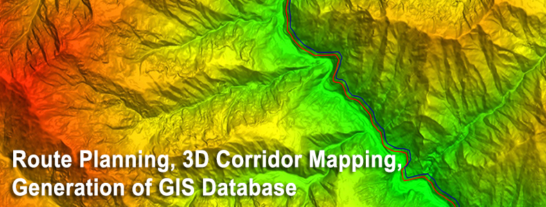
Scope of Work
- Procurement of Base Maps, Satellite Images and Government records and plans from
 required departments.
 - Preparation of Base Map and Digital Terrain Models.
- Identification of multiple corridors for evaluation based on design parameters.
- Preparation of corridor Alignment Sheets.
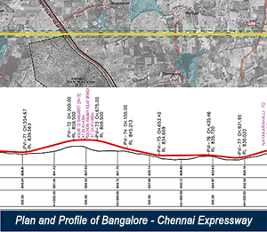
Major Projects
Over 65000 km of Cross Country pipeline projects.
Expressway alignments for:
- Mumbai – Vadodara expressway (380.6 km)
- Delhi – Meerut expressway (60 km)
- Chennai – Bangalore expressway (380.9 km)
- Delhi - Jaipur expressway