Scope of Work
Comprehensive domain knowledge including real world domain experience of over THREE DECADES in Pipelines, Property and Land Records, Highway, Irrigation and Water Resources, Public Health, Geotechnical, Surveying and Mapping, and associated engineering domains sets it apart from other Geospatial and software companies who have no in-house domain experience and knowledge.
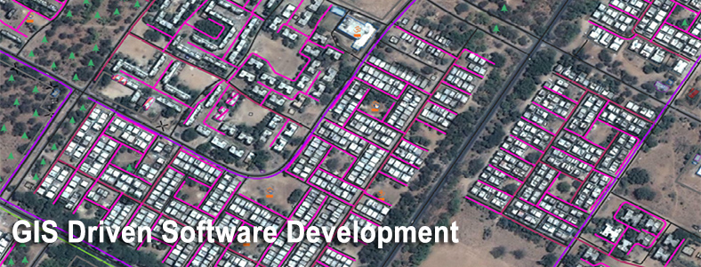
GIS AND SOFTWARE DEVELOPMENT
SECON has developed advanced GIS and Geo-spatial applications using multiple GIS platforms like:
- ESRI - ArcGIS Server, ArcGIS Desktop and Mobile
- Autodesk AutoCAD Map
- Bentley Microstation
- MapInfo MapXtreme
- Google Maps, Bing Maps
- Open Source Solutions like Map Guide, QGIS, Map Server, Open Street Maps
We deliver various software solutions using the following technologies:
- Microsoft .NET
- Android and IOS Mobile platforms
We also undertake project management and strategic consulting with professional services.
- ROUTE OPTIMIZATION AND CORRIDOR PLANNING
- Using the advanced GIS tools, developed in-house, we provide optimized route and corridor planning to our customers in Canals, Highways and Cross Country long distance pipelines.
- Extensive use of satellite imagery for data capture, updation, validation of land use and latest developments.
- Other tools used include DGPS, Total Stations and in-house software for presentation of deliverables like alignment sheets, crossing drawings, stratification, ground profile, property information etc. that enable SECON to execute major projects in Pipelines, Irrigation and Water Management, in record time.
Major Projects
- Mehsana -Bhatinda - Pipeline Information Management System (PIMS)
- Bhatinda-Jammu (PIMS)
- Mallavaram-Bhiwara (PIMS)
- Pipeline Asset Management System [PAMS-AMC]
- Sabarmati Gas Limited [SGL - AMC]
- Route Management System - GeoRMS
- Nokia Siemens Networks, Initial Scope PH1 and PH2
- NSN-P2 Web based GIS Component for Spatial View and Analysis.
- NSN-P2 Rework Web based GIS Component for Spatial View and Analysis. NSN-Rework
- Development of GIS / LIS for proposed pipeline from Bawana Tap off point to Nangal for a length of 525 Km - GAIL (India) Limited
- Geodatabase Creation for round Trip distance verification for Karnataka
City Gas Projects
- Procurement and Processing of High Resolution Satellite Images, establishment of Ground Control using DGPS, Preparation of GIS Base Map, GIS Database development and Development of Web based solution Pipeline Information Management System to manage City Gas distribution Network for 10 cities across Gujarat.
- Procurement and Processing of High Resolution Satellite Images, establishment of Ground Control using DGPS, Preparation of GIS Base Map, GIS database development and Development of Web based solution Pipeline Information Management System to manage City Gas distribution Network for 02 cities across Gujarat.
- Preparation of up-to-date GIS Base Map using High Resolution Satellite Image (0.6 m) and Development of Web based GIS Application / Database for planning City Gas Distribution Network for Bhavnagar & Kachchh Districts in Gujarat
- Procurement of Satellite Image, Processing of Satellite Imagery, Preparation of GIS Base Map and Development of Web based GIS Application / Database using Satellite Image to Support Viewing of Gas Network Details, other Utility Networks, Consumer Details, Emergency Assisting Details, Engineering, HSE, O&M, Marketing and Document Management System, etc for Mehsana, Sabarkantha & Gandhinagar Districts in the state of Gujarat
- Route Survey and Allied Works for City Gas Distribution project at Bengaluru for GAIL Gas Limited, Noida
GIS ANALYSIS APPLICATION FOR BUSINESS INTELLIGENCE
The GIS Analysis Application for Business Intelligence helps in the spatial analysis of telecommunication domain data. It provides a powerful geo-visualization and spatial analytics capabilities for business data using GIS vertical. It delivers 360° insight by integrating GIS with Business Intelligence and uses transactional and analytical capabilities to derive more meaningful insight into business critical KPIs.
CITY GAS GRID FOR DISTRIBUTION
Gas grid planning for 5 major cities