Key Features
Map Viewer
GIS Map of Karnataka showing supply locations, end points customers/retail outlets. Map will show major landmarks like bridges, village, and junctions Map viewer will have standard viewer features like zoomin, zoomout, print etc.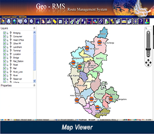
Shortest Route Calculations
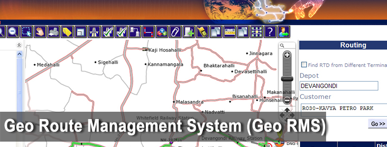
Point to Point Query [Routing Calculations
Dynamic Labeling
Set visibility Scales of Layer through the application
Import/Export the data
Query Builder
This functionality will allow user to edit the features in the following layers
Update
Support raster Images/scanned photographs
RTD Approval
RTD Approval Module is to approval of RTDs from Field Officers to General Manager. A RTD will be initiate by Secon then it will forward to Field officer and so on up to General Manager for final approval. If any changes in RTD are required it will revert at any stage to previous officer. All officers will get two pages on click of Administration button. All pages are as follows,
- Inbox
- Initiate
- RTD Approval Status
- GeoRMS also has facility for vehicle tracking for delivery and distribution
Project Executed
Route Management System - GeoRMS - Indian Oil Corporation Limited (IOCL)