FIRST INDIAN AIRBORNE LIDAR SURVEY FOR FLOOD IMPACT ASSESSMENT IN RAJASTHAN
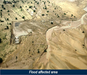
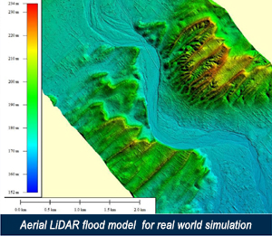
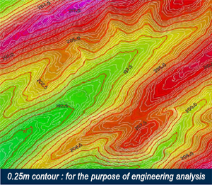
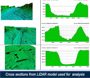
In August-2006, unprecedented flash floods occurred in Barmer district of Rajasthan, India severely affecting SECON’s client’s proposed surface facility areas of oil fields. Villages had stagnant water in the low-lying areas because of Gypsum-rich soil. Though engineers tried to in filter the water to sub surface, the gypsum prevented the water to seep in. The only way out was to drain out the water through evaporation. This became a major challenge for the project wherein all the engineering for the facilities were in the advanced stage. For the effective flood risk management, a detailed flood model study was carried out which required detailed topography survey of a substantial area within a shortest possible time. This data was crucial from the point of flood risk management.
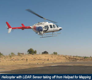
SECON executed an Aerial LiDAR survey combined with a ground survey to meet this requirement and successfully managed to provide the topographical details for the flood affected areas.