About US
SECON is the only company in India to provide comprehensive Multidisciplinary Solutions for the entire lifecycle of an Infrastructure project from Feasibility Studies, Surveying, Investigation, Planning, Design, Land Acquisition, Tendering, Construction Management, and GIS Based Asset Management.
SECON has long-term partnerships with International Engineering and Mapping Firms across Asia, North America, Africa, Middle East, Europe and Australia and has executed both Engineering and Mapping projects in these areas for its clients.
SECON is registered with Asian Development Bank (ADB) and DACON (World Bank) to provide consultancy services.
SECON has won the following awards:
- Geospatial World Excellence Award 2018 for Application of Geospatial Technology in Natural Gas Management
- Best Professionally Managed Company 2014 - Construction Industry Development Council (CIDC)
- Geospatial Company of the Year 2013 - India Geospatial Forum 2014
- Best Project for Urban Infrastructure 2011 - Construction Industry Development Council (CIDC)
- Export Excellence Award (Gold) 2010 - Federation of Karnataka Chambers of Commerce & Industry (FKCCI)
- Export Excellence Award (Silver) 2008 - Federation of Karnataka Chambers of Commerce & Industry (FKCCI)
- Certificate of Appreciation 2012 - Gas Authority of India Limited (GAIL)
- Woman Consultant of the Year 2012 - Consulting Engineers Association of India (CEAI)
- Woman Consultant of the Year 2009 - Consulting Engineers Association of India (CEAI)
SECON has the following standing in India:
The leading Firm for Survey, Planning and Design of large Irrigation, Flood Control and Water Management Projects.
One of the Largest and most Experienced Firms for Land Acquisition Assistance for Pipeline, Highway and other Infrastructure Projects. SECON has developed customized web enabled software for Data Management and administration of this Complex Process which have included the compilation and data management more than 10 million properties compiled by SECON as of date.
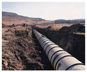
One of the largest and most experienced firms for Oil and Gas Pipeline and City Gas Planning Projects in India.
One of few firms in India to have the NABL certification for its Geotechnical Laboratory. NABL is the National Accreditation Board for Testing and Calibration of Laboratories (NABL).
One of the Largest, Oldest and most experienced Private Company for Topographic, Precision Engineering and Cadastral Surveys.
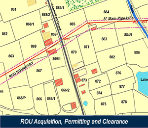
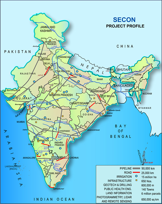
65,000 km of large-scale Pipeline Mapping – this includes Route Engineering, Satellite and Ground Topographical and Cadastral Mapping, Right-of-Way Acquisition assistance and management, Clearances and Permitting, GIS Based Database Compilation and Web Based GIS Software Development. This is the largest amount of Pipeline mapping done by any corporation in India
26000 Sq Km of Irrigation and Water Management design projects. SECON is currently executing and Irrigation Mapping and Design Project for an area of 14000 sq km for the Narmada River Basin in Madhya Pradesh. This project was done by mapping with a combination of High Resolution (0.5 m) Stereo Satellite Imagery and validated for accuracy by Land Survey Method. This technology is being used for the first time in India for an Irrigation and Water Management project and the mapping accuracies achieved in this project were a benchmark even for the Satellite Image provider.
12000 sq km of large-scale land surveying (topographical and cadastral) for Irrigation projects. This includes the Topographic and Cadastral Mapping of 6000 Sq Km for the World Bank Aided Uttar Pradesh Water System Restructuring Project.
21000 km of surveying, investigation, design, and construction supervision of highways
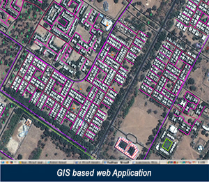
City Gas Distribution Planning for 22 cities. Work included Satellite Mapping and Ground Survey and Validation, Consumer Indexing, Network Planning, GIS Database Compilation and development of Web Based GIS Applications
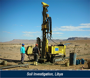
600,000 meters of geotechnical investigation and drilling in various soil strata including investigations for the Bangalore International Airport.
600 infrastructure development projects (includes subdivision/township mapping, design and planning) which includes construction quality control survey for the International Tech Park (ITPL) in Bangalore.
SECON has completed a major multimillion dollar mapping and consulting project for the planning and design of the infrastructure for 100 towns in Libya. The capital expenditure of the project is around 2.5 billion US$.
The scope of work for this project included Surveying, Satellite Image Mapping, Geotechnical Investigations, and Design and Preparation of Construction Tender documents for Water Supply, Sewerage, Storm Water, Road, Electrical Distribution and Telecommunications.
SECON has successfully completed the Multi Million Dollar Contract for Project Management Consultancy Services for Up Gradation of important Road Corridors in Bangalore Urban and Rural Districts for a length of 1004 Km. Estimated capital expenditure of the project is 9.96 Billion Rupees(US $ 220 million).
SECON has successfully completed more than 1,000,000 Sq Km of LiDAR, Photogrammetry and Remote Sensing Projects as of December 2014.
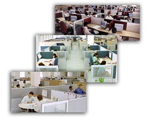
SECON has a state of the art 105,000 sq ft, ISO 9001:2015 certified operations center set on a 2.5 acre campus in Bangalore, India that is fully owned by the company. Bangalore is the technology capital of India and is globally recognized for its technical excellence.
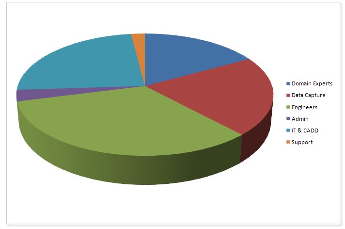
THE DOMAIN EXPERTISE OF SECON COMPRISES :
Design Consultancy and Engineering Services
- Irrigation, Flood Control and Water Management
- Highway Engineering and Construction Supervision
- Oil & Gas Pipeline Transportation
- Public Health Engineering
- Establishment of GIS Based Property Ownership Records and Land Information Systems
- Land Acquisition, Permitting and Clearances
- GIS Driven Software Development
- Environment Impact Assessment and Management
- Town Planning and Urban Development
- Electrical Engineering
- Project Feasibility, Financial Institutions Lender Evaluation
- Vendor Evaluation and Selection
- Urban Planning
- City Gas Network Mapping and Planning
Surveying, Mapping and Investigation Services
- Engineering, Property and Hydrographic Surveys
- Geotechnical Engineering
- Aerial Surveys and Mapping
- LiDAR Mapping
- Photogrammetry
- Remote Sensing
- Underground Utility Detection and Non Destructive Testing
- Underwater Leak Detection and Turnkey Solutions for Dams and underwater Structures
- GIS/CADD Data Development and Maintenance
- Route Planning and 3D Corridor Mapping
- Ground Water and Resistivity Surveys
- Terrain evaluation and Geological Appraisal